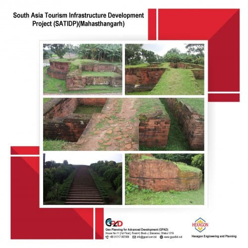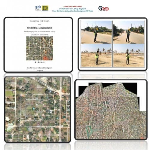
Project Description
RPAS (Drone) Survey of the Raw Water Pipeline route under Saidabad WTP Phase-3, Component-1 capture 24.68 km area. RPAS (Drone) Survey of sections of Raw Water Pipeline route stated following activities:
• Orthophoto collection
• Georeferenced orthomosaic processing
• Base feature digitization shapefile preparation
• Field data collection and attribute update
• RPAS (drone) survey undertaken to capture Orthophotographs along the pipeline route
• Topographic Survey undertaken to capture required elevation data along the pipeline route