Project Description
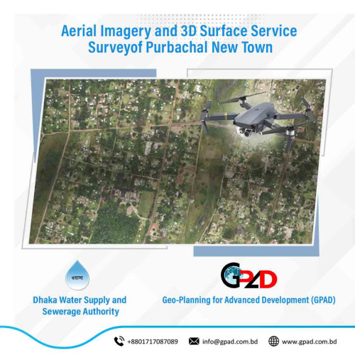
The main objective of the projects is to capture aerial imagery and 3D surface service of whole project including georeferenced aerial images, georeferenced 3D point cloud and survey report.
The main objective of the projects is to capture aerial imagery and 3D surface service of whole project including georeferenced aerial images, georeferenced 3D point cloud and survey report.
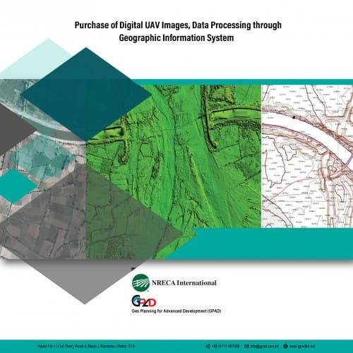 Purchase of Digital UAV Images, Data Processing through Geographic Information System
Details
Purchase of Digital UAV Images, Data Processing through Geographic Information System
Details
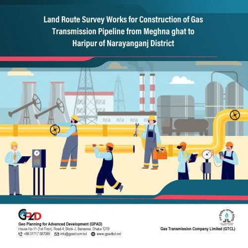 Land Route Survey Works for Construction of Gas Transmission Pipeline from Meghna ghat to Haripur of Narayanganj District
Details
Land Route Survey Works for Construction of Gas Transmission Pipeline from Meghna ghat to Haripur of Narayanganj District
Details
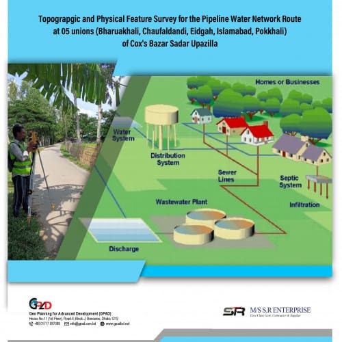 Topograpgic and Physical Feature Survey for the Pipeline Water Network Route at 05 unions (Bharuakhali, Chaufaldandi, Eidgah, Islamabad, Pokkhali) of Cox's Bazar Sadar Upazilla
Details
Topograpgic and Physical Feature Survey for the Pipeline Water Network Route at 05 unions (Bharuakhali, Chaufaldandi, Eidgah, Islamabad, Pokkhali) of Cox's Bazar Sadar Upazilla
Details
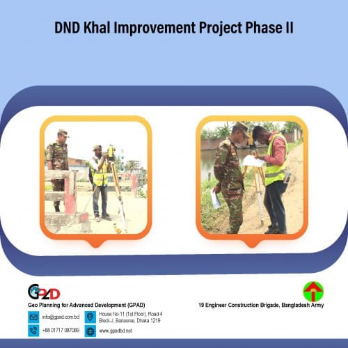 DND Khal Improvement Project Phase II
Details
DND Khal Improvement Project Phase II
Details
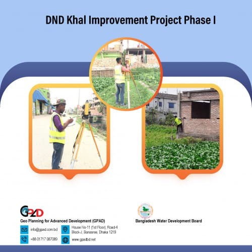 DND Khal Improvement Project Phase I
Details
DND Khal Improvement Project Phase I
Details
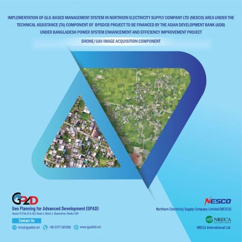 Implementation of GlSbased Management System in Northern Electricity Supply Company Ltd (NESCO) area under the Technical Assistance (TA) component of BPSDCB Project to be financed by the Asian Development Bank (ADB) under Bangladesh Power System Enhanceme
Details
Implementation of GlSbased Management System in Northern Electricity Supply Company Ltd (NESCO) area under the Technical Assistance (TA) component of BPSDCB Project to be financed by the Asian Development Bank (ADB) under Bangladesh Power System Enhanceme
Details
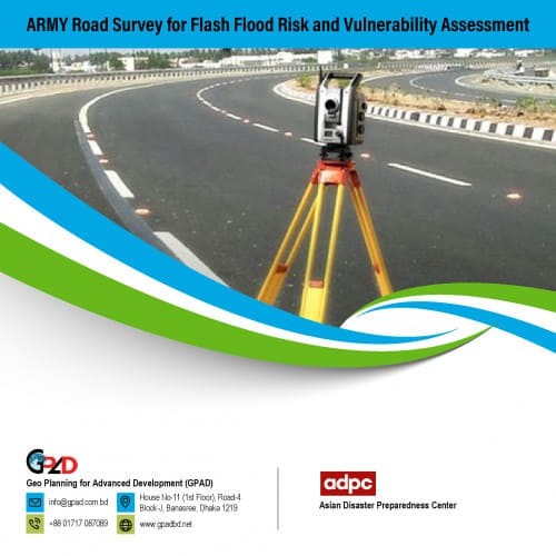 ARMY Road Survey for Flash Flood Risk and Vulnerability Assessment
Details
ARMY Road Survey for Flash Flood Risk and Vulnerability Assessment
Details
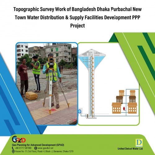 Topographic Survey Work of Bangladesh Dhaka Purbachal New Town Water Distribution & Supply Facilities Development PPP Project
Details
Topographic Survey Work of Bangladesh Dhaka Purbachal New Town Water Distribution & Supply Facilities Development PPP Project
Details
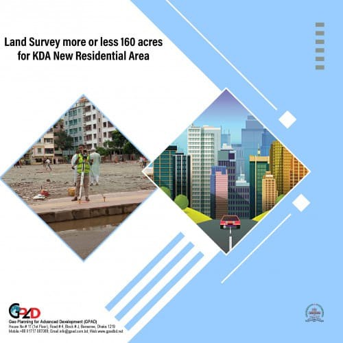 Land Survey more or less 160 acres for KDA New Residential Area
Details
Land Survey more or less 160 acres for KDA New Residential Area
Details
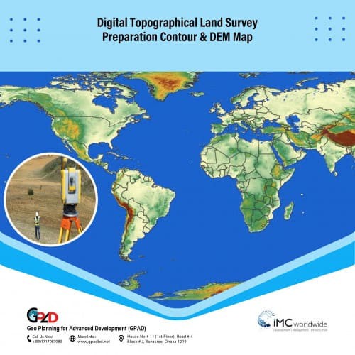 Digital Topographical Land Survey, Preparation Contour & DEM Map
Details
Digital Topographical Land Survey, Preparation Contour & DEM Map
Details
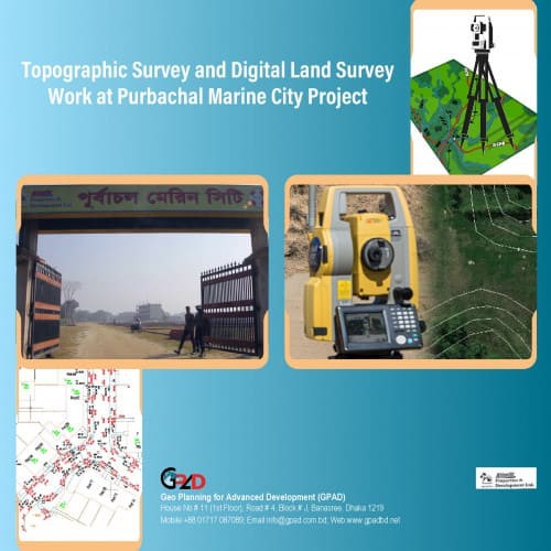 Topographic Survey and Digital Land Survey Work at Purbachal Marine City Project
Details
Topographic Survey and Digital Land Survey Work at Purbachal Marine City Project
Details
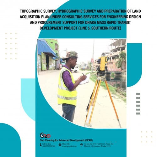 Topographic survey, hydrographic survey and preparation of land acquisition plan under consulting services for engineering design and procurement support for Dhaka mass rapid transit development project (Line 5, southern route)
Details
Topographic survey, hydrographic survey and preparation of land acquisition plan under consulting services for engineering design and procurement support for Dhaka mass rapid transit development project (Line 5, southern route)
Details
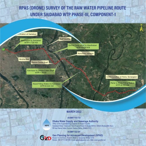 RPAS (Drone) Survey of the Raw Water Pipeline Route Under Saidabad WTP Phase-III, Component-1
Details
RPAS (Drone) Survey of the Raw Water Pipeline Route Under Saidabad WTP Phase-III, Component-1
Details
 Spatial Database Preparation and GIS Mapping
Details
Spatial Database Preparation and GIS Mapping
Details
 GIS Map Preparation of some selected wards of Dhaka City (Ward No. 49 and 64, Dhaka South City Corporation)
Details
GIS Map Preparation of some selected wards of Dhaka City (Ward No. 49 and 64, Dhaka South City Corporation)
Details
 Hazard Map Preparation of some selected wards of Dhaka City (Ward No. 10, 11 and 12, Dhaka North City Corporation)
Details
Hazard Map Preparation of some selected wards of Dhaka City (Ward No. 10, 11 and 12, Dhaka North City Corporation)
Details
 GPS and Total station Based Advanced Topographic Survey and Preparation of Layout Plans for Eco Tourism Site
Details
GPS and Total station Based Advanced Topographic Survey and Preparation of Layout Plans for Eco Tourism Site
Details
 Digital Road Survey Work Chunkutia Road, Mirerbazar Bazar to Kaliganj Bazar & Karaniganj Model Thana to Kaliganj Jora Bridge at Karaniganj, Dhaka
Details
Digital Road Survey Work Chunkutia Road, Mirerbazar Bazar to Kaliganj Bazar & Karaniganj Model Thana to Kaliganj Jora Bridge at Karaniganj, Dhaka
Details
 Consultancy Services for GNSS/RTK Survey (Static) and Field Layout Checking and Estern Housing – Swadesh Properties Ltd.
Details
Consultancy Services for GNSS/RTK Survey (Static) and Field Layout Checking and Estern Housing – Swadesh Properties Ltd.
Details
 Consultancy Services for GNSS/RTK Survey (Static) and Boundary Demarcation – Sornali Residential Area, Swadesh Properties Ltd.
Details
Consultancy Services for GNSS/RTK Survey (Static) and Boundary Demarcation – Sornali Residential Area, Swadesh Properties Ltd.
Details
 Digital Land Survey of 40 Katha Land adjacent with Hatirjheel Area.
Details
Digital Land Survey of 40 Katha Land adjacent with Hatirjheel Area.
Details
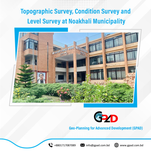 Topographic Survey, Condition Survey and Level Survey at Noakhali Municipality
Details
Topographic Survey, Condition Survey and Level Survey at Noakhali Municipality
Details
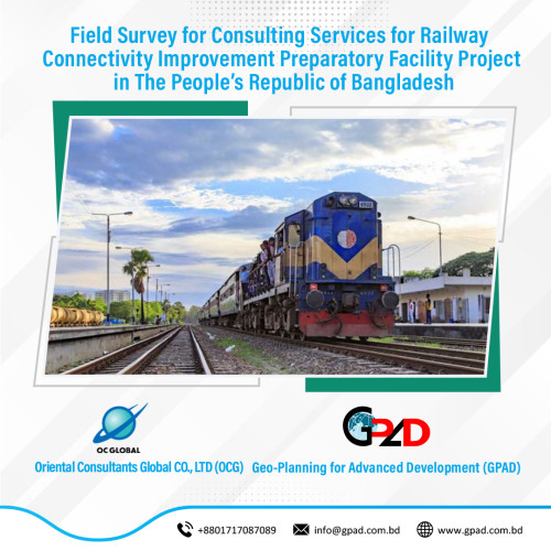 Field Survey for Consulting Services for Railway Connectivity Improvement Preparatory Facility Project in The People’s Republic of Bangladesh
Details
Field Survey for Consulting Services for Railway Connectivity Improvement Preparatory Facility Project in The People’s Republic of Bangladesh
Details
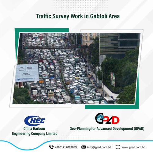 Traffic Survey Work in Gabtoli Area
Details
Traffic Survey Work in Gabtoli Area
Details
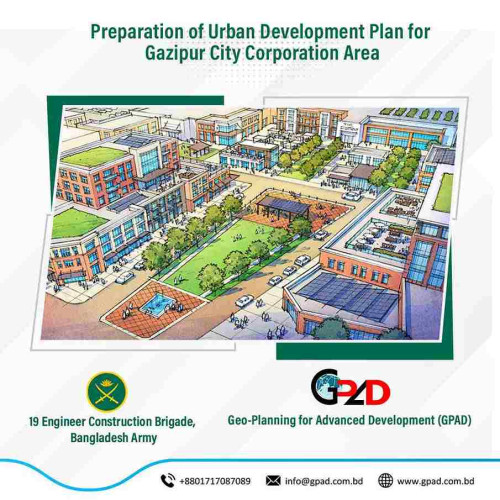 Preparation of Urban Development Plan for Gazipur City Corporation Area
Details
Preparation of Urban Development Plan for Gazipur City Corporation Area
Details
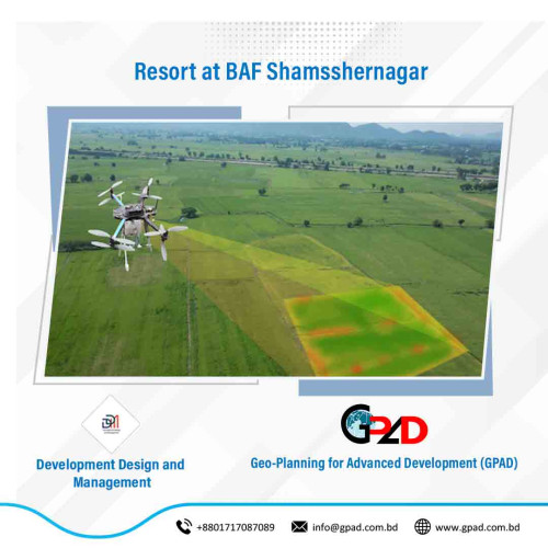 Resort at BAF Shamsshernagar
Details
Resort at BAF Shamsshernagar
Details
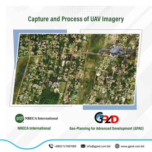 Capture and Process of UAV Imagery
Details
Capture and Process of UAV Imagery
Details
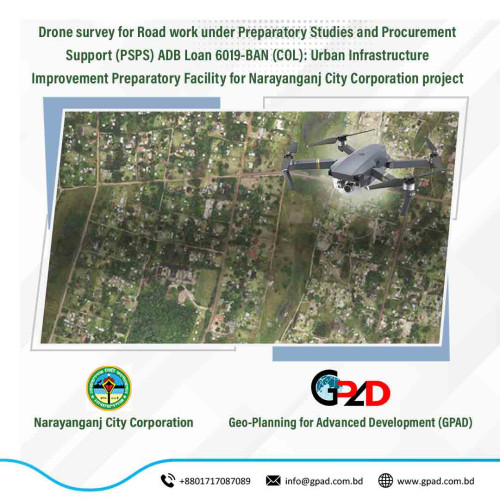 Drone survey for Road work under Preparatory Studies and Procurement Support (PSPS) ADB Loan 6019-BAN (COL): Urban Infrastructure Improvement Preparatory Facility for Narayanganj City Corporation project
Details
Drone survey for Road work under Preparatory Studies and Procurement Support (PSPS) ADB Loan 6019-BAN (COL): Urban Infrastructure Improvement Preparatory Facility for Narayanganj City Corporation project
Details
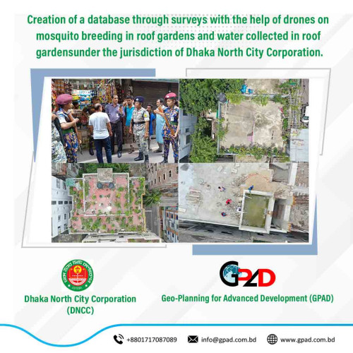 Creation of a database through surveys with the help of drones on mosquito breeding in roof gardens and water collected in roof gardens under the jurisdiction of Dhaka North City Corporation
Details
Creation of a database through surveys with the help of drones on mosquito breeding in roof gardens and water collected in roof gardens under the jurisdiction of Dhaka North City Corporation
Details
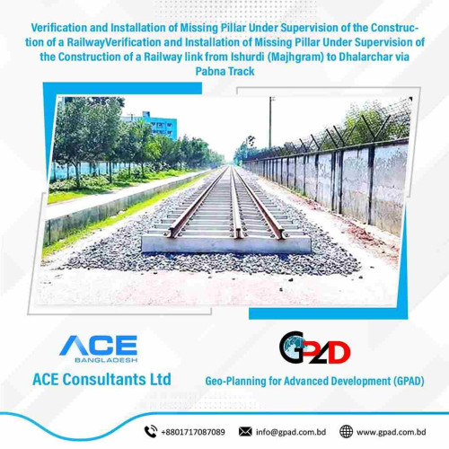 Verification and Installation of Missing Pillar Under Supervision of the Construction of a RailwayVerification and Installation of Missing Pillar Under Supervision of the Construction of a Railway link from Ishurdi (Majhgram) to Dhalarchar via Pabna Track
Details
Verification and Installation of Missing Pillar Under Supervision of the Construction of a RailwayVerification and Installation of Missing Pillar Under Supervision of the Construction of a Railway link from Ishurdi (Majhgram) to Dhalarchar via Pabna Track
Details
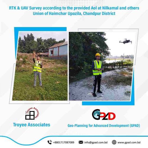 RTK & UAV Survey according to the provided Aol at Nilkamal and others Union of Haimchar Upazila, Chandpur District.
Details
RTK & UAV Survey according to the provided Aol at Nilkamal and others Union of Haimchar Upazila, Chandpur District.
Details